Real-time route
Your path on the map as you move, with current temperature and wind.
Pace, distance, elevation and calories in real time on the map. And something no running app does: every zone you cross paints and becomes yours, until someone comes to take it.
GPS tracking and territory, free and with unlimited activities
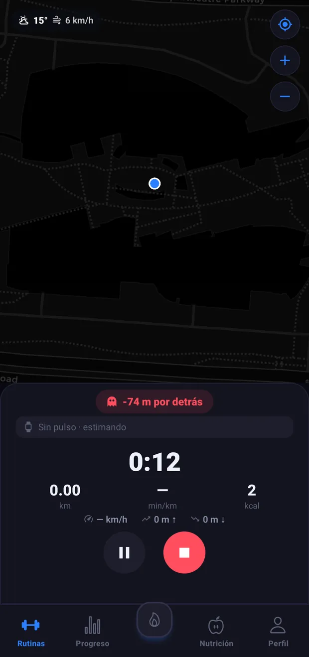
Press start and the route draws itself on the map. Pace per kilometer, distance, cumulative elevation and calories, all live and with the session protected by a persistent notification so Android doesn't kill it halfway.
Your path on the map as you move, with current temperature and wind.
Minutes per kilometer, speed, meters climbed and descended. Without opening another screen.
With a connected watch your frequency is shown; without it, expenditure is estimated.
The calories from the workout enter your nutrition balance without duplicating with the watch.
The map is divided into cells. The ones you step on paint with your color. If you return more times than someone else, that cell is yours and appears in the global conquest ranking. And if someone steals it from you, you get an alert.
Every workout expands your stain on the map. The neighborhood is conquered by running.
Classification by dominated cells, with your position and total players.
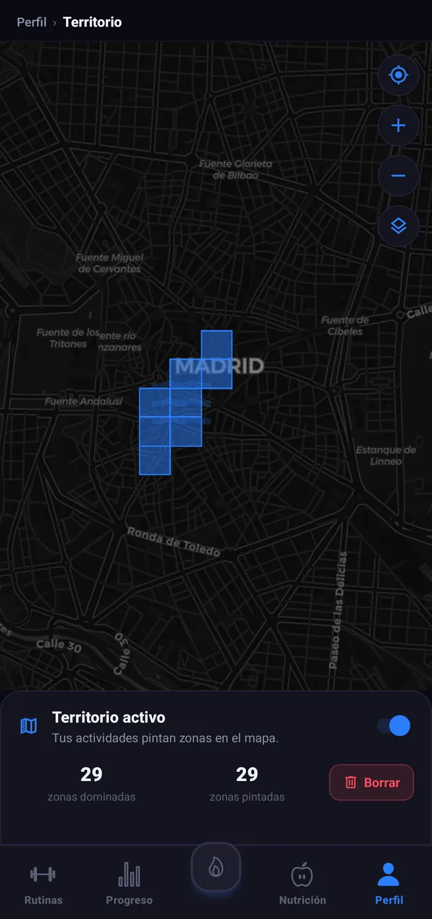
If another user passes through one of your cells more times than you, you find out.
Filter the map to see your territory, your team's or others'.
The problem with cardio is not the effort, it's the lack of a reason to repeat it. Running apps have spent years solving measurement —pace, distance, elevation— and almost none solves the only question that matters on a Tuesday in November at seven in the evening: why go out today.
VortLoop measures just as well as the rest. What it adds is a reason: the map paints, and what you've painted can be lost.
The world is divided into a grid of cells. When you do a GPS activity, all the cells your route passes through are marked as painted by you.
A painted cell is not yet your cell. The ownership of each cell is decided by who has passed through it the most times and, in case of a tie, by who did so most recently. That means territory does not accumulate and is forgotten: you have to maintain it.
Your count of painted and dominated cells appears on your profile, and the global ranking orders all players by dominated cells. You can see your position even if you are out of the top.
A carelessly built map game is a stalking tool. If anyone can see the exact cell someone dominates, and that cell is their portal, the game is no longer a game.
That is why there are three intentional decisions, and none is negotiable for fun:
Territory is optional and activated with explicit consent: if you don't turn it on, your routes paint nothing and you don't appear in the ranking. When you look at another player from the leaderboard, the map takes you to a wide, blurred area —on the scale of a dozen kilometers, city level— with added random offset, never a specific cell. And routes are never shown with the exact starting point as public data.
It is less spectacular than showing the complete map of the whole world. It is also the difference between a fun feature and a serious problem.
The same criteria apply throughout the app: nothing that allows physically locating a specific person.
The map has layers that you can turn on and off on the fly: your territory, your team's, other players' and the reference grid. Changing layers doesn't query anything again, so it's instant, and your preference is remembered.
The controls are the same on all map screens in the app: zoom in, zoom out, and center on your actual position, which is the first thing you look for when you open a map and find yourself looking at another city.
If you use a sports watch, VortLoop connects through Health Connect, Android's health hub. That means you don't depend on the brand: Garmin, Fitbit, Samsung, Oura, WHOOP, and Coros all write there, so a single connection covers them.
Activities you record in VortLoop can be saved to Health Connect, and workouts you've done with another app can be read from there, with over eighty activity types recognized and translated.
When your workout and a watch session coincide in time, the app doesn't count them twice: it understands they are the same activity and enriches your workout with the watch's metrics —average and max heart rate, calories, and distance— under the heading "Your watch recorded", so you know where each number comes from.
Not all cardio is going outside. When your goal is fat loss, the routine generator adds cardio blocks spread between strength days, with countdowns, voice prompts, and hydration reminders in long blocks.
They are explained on the AI routines page. The difference is only where you do it: in both cases it adds to your day's balance and your progress.
GPS tracking needs location permission and runs in the background while the activity lasts, with a always-visible notification you can tap to return to the screen. It stops when you stop: the app doesn't track your position outside of an activity started by you.
Territory is calculated from routes you've already logged, not continuous tracking. And you can turn it off whenever you want without losing your activities.
The obvious question if you run or cycle. The short answer: Strava wins on segments and power analysis, and VortLoop offers another way to compete. The long one, in VortLoop vs Strava.
GPS tracking, the map, unlimited activities, territory, and the ranking are in the Free plan. There is no limit on outings or metric trimming.
What paid plans bring is the analytical layer: crossing your cardio with training, rest, and nutrition on the progress page.
Download VortLoop for free and get the full app.